The Gazetteer For A Frankenstein Atlas
Cruttwell, Clement. A Gazetteer of France. Vol. 2. London: G.G.J. and J. Robinson, 1793.
What is a Gazetteer?
A "gazetteer" is a geographical dictionary that supplements the information found in maps. Information in a gazetteer might include social, geological, or administrative information that provides richer insights into the material under analysis.
In its simplest form, a gazetteer is an alphabetical list of locations that provides basic geographical information. In Mary Shelley's lifetime, travelers could use these to help them navigate from place to place. Take, for example, the Gazetteer of France, published in 1793. The entries in the text are relatively simple, generally situating places in relation to other towns and villages. For example, the text for Montluel reads
Montluel, a town of Bresse, situated in a fertile country on the Serraine, in the diocese of Lyons, and bailiwick of Bourg; 12 leagues from Bourg, 6 from Lyons, 36 1/2 from Geneva, and 121 1/2 from Paris. p. Bourg-en-Bresse.
As tourism increased over the course of the late eighteenth and nineteenth centuries, writers of gazetteers focused on developing books that had useful information for travelers. These might include highlights about local history or details on country houses to visit in the area (see, for example, Crosby’s Complete Pocket Gazetteer of England and Wales. London, 1815).
And, as European empires and trade continued to expand in the eighteenth century, so too did the scope and scale of gazetteers. With greater access to printed materials, including newspapers and novels, gazetteers provided useful reference guides to foreign locales. In the age of encyclopedias, gazetteers encompassed the mass of geographical information flowing in from travelers, armies, and surveyors.
Gazetteers served both educational and rhetorical functions. They could narrate histories about regions, nations, and even families. Contemporary writers highlighted the expansion of empires. Patrons encouraged authors of gazetteers to highlight the deep roots of their lineage in a region similarly to chorographical works, such as English county histories published during this period (see, for example, Gilbert, Charles Sandoe. An Historical Survey of the County of Cornwall. 2v. in 3. vols. Plymouth-Dock: J. Congdon, 1817). Writers found gazetteers valuable resources to construct their stories. It is quite possible that Shelley consulted maps and gazetteers as she plotted the action in her novel.
Gazetteers and Digital Humanities
Gazetteers remain essential to the work of geographers and historians. This is especially true in the realm of the digital humanities where scholars often work with large data sets and require standardization of place names and geographical coordinates. A number of new projects are in process, which are focused on building open access digital historical gazetteers and atlases. Representative examples include the Pleiades dataset, which is a digital version of the Barrington Atlas of the Greek and Roman World created by Pleiades and the Digital Atlas of Roman and Medieval Civilization (DARMC) project at Harvard. For the early modern world, the Map of Early Modern London Project has created The MoEML Gazetteer of Early Modern London. Over the past several years, scholars associated with the Pelagios Commons have been creating an Open Linked Data framework for historical geography to which numerous projects contribute.
Our Schema
The Gazetteer for A Frankenstein Atlas is a work-in-progress. The research team has extracted all the place name data from Frankenstein. This includes names of specific locations, such as "Geneva," but it also includes ambiguous location data, such as "the cottage" of the de Lacey family. In addition to basic geographical data, we have linked all locations to each scene in the novel. This allows us to trace Shelley’s shifting representation of location over time.
For each location-scene, we have identified character who are in the scene and the location. We have given them their own codes
Using the schema that we have developed, the gazetteer includes the following data fields.
uniqueID: determined by a scene specific to a time and place. If the same location is revisited in the book, this new scene will have a new uniqueID.
latitude: decimal coordinates
longitude: decimal coordinates
loc_name_shelley: name of location as labelled by Mary Shelley
loc_name_18c: alternative 18th century name of loc_name_shelley (for example, Shelley's "Mayence" is labelled "Mainz" in this field)
loc_name_modern: modern name of the location
loc_type [dropdown list]: The location types that we use in A Frankenstein Atlas are modified from A Literary Atlas of Europe/Ein literarischer Atlas Europas as described by Barbara Piatti in "Mapping Fiction: The Theories, Tools, and Potentials of Literary Cartography" in Literary Mapping in the Digital Age, ed. David Cooper, et al. (Routledge, 2016), 92-93.
loc_action: location of the action; a specific point in space
loc_zone: zone of action; multiple, undefined locations
loc_projected: projected places/spaces; locations that exist in the world; referred to but not visited which are tied to a character's memory, dream, or desire
loc_topmarker: places mentioned in the text but not part of action
loc_path: paths and routes; trajectory in space of action
loc_imaginary: spaces that do not exist in the world; imagined by characters
loc_extratextual: locations mentioned in the book that are not part of the narrative; e.g. locations mentioned on title page, in editor's footnotes, etc.
action type of action done in a location during a scene
action_emotive: emotive actions reflect Mary Shelley’s description of a character’s emotion in any given scene; each character can be tagged with an emotive action (defined by the list below) for each location-scene
action_emotive_victor [dropdown list]
action_emotive_anger
action_emotive_longing
action_emotive_sadness
action_emotive_happiness
action_emotive_contentment
action_emotive_suspicion
action_emotive_madness
action_emotive_fear
action_emotive_enthusiasm
action_emotive_pride
action_emotive_contempt
action_emotive_surprise
action_emotive_love
action_emotive_disgust
action_emotive_jealousy
action_emotive_guilt
action_emotive_creature [dropdown list]
action_emotive_walton [dropdown list]
action_emotive_clerval [dropdown list]
action_emotive_alphonse [dropdown list]
action_emotive_caroline [dropdown list]
action_emotive_elizabeth [dropdown list]
action_emotive_william [dropdown list]
action_emotive_justine [dropdown list]
action_emotive_felix [dropdown list]
action_emotive_safie [dropdown list]
action_emotive_agatha [dropdown list]
action_emotive_delacey [dropdown list]
action_emotive_waldman [dropdown list]
action_emotive_krempe [dropdown list]
action_emotive_kirwin [dropdown list]
action_physical: reflects Mary Shelley’s description of a character’s physical actions in any given scene; each character can be tagged with an physical action (defined by the list below) for each location-scene
action_physical_victor [dropdown list]
action_physical_violence
action_physical_escape
action_physical_confrontation
action_physical_dialogue
action_physical_hiding
action_physical_learningsolitary
action_physical_learningcollectively
action_physical_creature [dropdown list]
action_physical_walton [dropdown list]
action_physical_clerval [dropdown list]
action_physical_alphonse [dropdown list]
action_physical_caroline [dropdown list]
action_physical_elizabeth [dropdown list]
action_physical_william [dropdown list]
action_physical_justine [dropdown list]
action_physical_felix [dropdown list]
action_physical_safie [dropdown list]
action_physical_agatha [dropdown list]
action_physical_delacey [dropdown list]
action_physical_waldman [dropdown list]
action_physical_krempe [dropdown list]
action_physical_kirwin [dropdown list]
nature: fields for nature focus on the setting in which any scene takes place and attempt to describe both the physical conditions and any aesthetic concepts that Mary Shelley links to it
nature_setting [dropdown list]: general description of the setting of the scene
nature_setting_city
nature_setting_village
nature_setting_rural
nature_setting_wilderness
nature_setting_ship
nature_loc [dropdown list]: interior or exterior
nature_loc_interior
nature_loc_exterior
nature_aesthetic [dropdown list]: aesthetic categories alluded to to or noted directly in the text
nature_aesthetic_beautiful: descriptions that match contemporary notions of “beautiful”—often bucolic, rural, peaceful settings
nature_aesthetic_sublime: descriptions evoking contemporary notions of the sublime”—strong passions evoked by a natural setting, the awe inspired by a natural setting, the overwhelming sense of nature’s power, or the evocation of an omnipotent creator through nature
nature_aesthetic_revulsion: not fitting the categories of the sublime or beautiful, Mary Shelley’s characters often experience revulsion when the “natural” is manipulated to create monstrosities
nature_aesthetic_na: not applicable
nature_weather [dropdown list]: description of weather patterns
nature_weather_rain
nature_weather_thunderstorm
nature_weather_fog
nature_weather_clear
nature_weather_snow
nature_weather_na
nature_time [dropdown list]: time of day
nature_time_night
nature_time_day
nature_topography [dropdown list]: description of topography in a scene
nature_valley
nature_mountain
nature_plain
nature_sea
nature_river
nature_ice
nature_coastal
nature_forest
nature_na
name This is an open field for the name of the narrator of the text in a specific scene. All participants in that scene are actants, while those referenced in the text (either by the narrator or through the dialogue) but not present in the scene are ref. Any books mentioned in the scene can be added to the name_book field.
name_narrator name_actant1 **name_actant2 name_actant3 name_actant4 name_actant5 name_ref1 name_ref2 name_ref3 name_ref4 name_ref5 name_book1 name_book2 name_book3 name_book4 name_book5
extract This is a representative extract of text that mentions the location being described in the scene.
To access the Gazetteer or provide updates or revisions, visit the Github page for A Frankenstein Atlas.
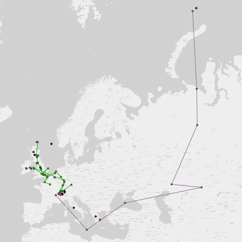
Interactive Map of Frankenstein
Our interactive map includes a list of all locations mentioned in Shelley's 1818 edition of Frankenstein. It is color coded to loc-type (see above). Page numbers refer to Shelley, Mary. Frankenstein. Edited by J. Paul Hunter. 2nd ed. New York: W. W. Norton & Company, 2012. If you would like to extend this interactive map, feel free to branch the .kmz file available on our Github page.


